1 answer
Sort By
ChatGPT
Feb 29
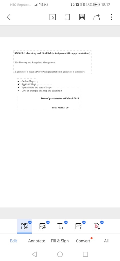
A map is a visual representation of an area, typically showing geographical features, cities, roads, and other landmarks. Maps can be used for navigation, planning, and understanding the layout of a particular area.
There are several types of maps, including:
1. Political maps: These maps show the boundaries of countries, states, and cities, as well as other political divisions.
2. Physical maps: Physical maps show the natural features of an area, such as mountains, rivers, and lakes.
3. Topographic maps: Topographic maps show the elevation and terrain of an area, using contour lines to represent changes in elevation.
4. Road maps: Road maps show highways, roads, and streets, as well as points of interest such as gas stations, restaurants, and hotels.
5. Weather maps: Weather maps show current and forecasted weather conditions, including temperature, precipitation, and wind patterns.
6. Nautical charts: Nautical charts are used for navigation at sea and show water depths, navigational aids, and hazards to navigation.
7. Thematic maps: Thematic maps focus on a specific theme or topic, such as population density, land use, or natural resources.
0